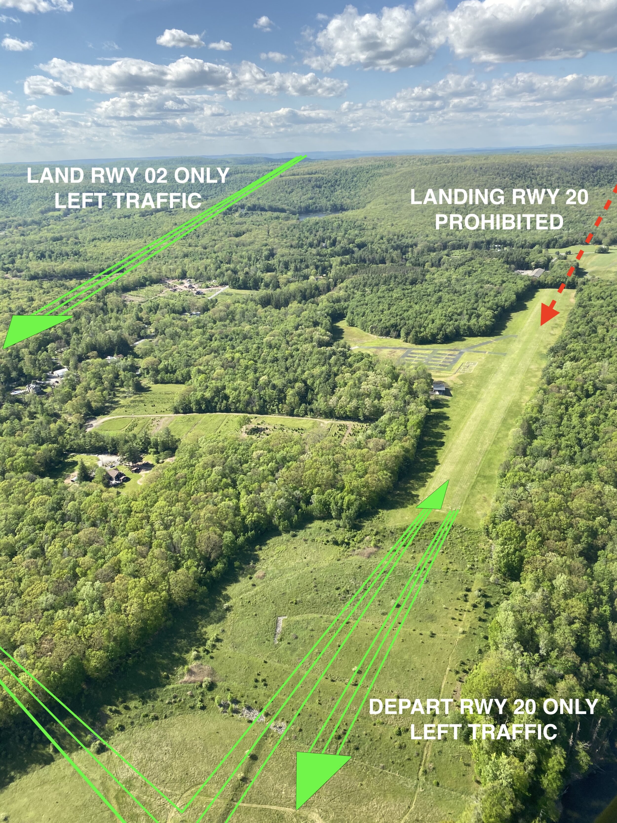
What pilots need to know.

Photographer is facing south.

Photographer is facing south.

One-way in. One-way out.

Land to the north, take off to the south.

Our runway is 2,405 feet long and on a 4.5% grade. The northern threshold is 1,430’ MSL while the southern threshold is 1,320’ MSL.

Landing on runway 20 is prohibited. The downslope and trees at the northern threshold make touching down and stopping hazardous. See pattern diagram below.

 
Photographer is on final (020º).

Photographer is on final (020º).

Safety first.

Make sure conditions are right for the unusual traffic pattern at 8N4. When tailwinds (from the south) are strong or conditions are gusty, it is best to take a raincheck or divert to Pocono Mountains Municipal Airport (MPO) 8nm WSW of us.

Pilots should announce intentions on CTAF 122.9.

Here is a VFR map for context.

 
Traffic pattern altitude is 2,400’ MSL. TDZE is approximately 1,350’ MSL.

Traffic pattern altitude is 2,400’ MSL. TDZE is approximately 1,350’ MSL.